


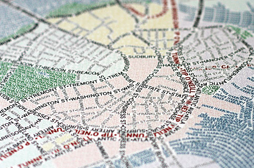
Axis Maps just released their mapping / art project Typographic Maps. These unique maps accurately depict the streets and highways, parks, neighborhoods, coastlines, and physical features of the city using nothing but type. Only by manually weaving together thousands upon thousands of carefully placed words does the full picture of the city emerge. Every single piece of type was manually placed, a process that took hundreds of hours to complete for each map.
Take a look at their blog for more on how these maps were made.
[via]